
Entries by Monsoon Martin (572)
SUPER BOWL LII FORECAST
 All credit for this brilliant image goes to Trevor Wagner, former student and current friend, who, in a Facebook post, referred to Bill Belichick as "Mama Fratelli in a hoodie." I Googled the genius phrase and lo and behold, someone had made the comparison, because it's the internet and of course someone had made this. If I Googled "Stratford-upon-Avon diaper rash walrus," I'm sure something would come up, and I'm positive I wouldn't want to see it.I'm just a little bit excited about the Eagles being in their third-ever Super Bowl and, I predict, finally winning the damn thing.
Eagles 27, Patriots 10.
Now to the weather. We got some proper snow this morning into early afternoon. I expected light snow showers before a rapid changeover to plain rain. And yet, there it was, proper snowing as I drove to Corropolese to pick up my tomato pie for the big game.
So if you're reading this on Sunday afternoon, some secondary roads are still slick - there's a solid coating of snow with a freezing-rain crust on top. But as temperatures rise into the mid and upper 30s and plain rain predominates, expect roads to be just fine.
Rain is finished by 7-8pm. Temperatures will dip into the upper 20s overnight and it'll be windy as (deflated) balls by AM commute time. But I don't expect to see many delays - especially given the fact that we may be looking at a snow day midweek.
Chance of delay Monday 2/5, 12.77%
Chance of cancellation Monday 2/5, 3.29%
So Monday becomes sunny with gusty winds and a high only in the upper 20s.
Tuesday is variably cloudy with a slight chance of snow showers in the afternoon and evening, signifying nothing.
Wednesday is the interesting day. By 2-4am we should see snow develop. This continues on and off until 10-12, when temperatures rise into the upper 30s and we see precipitation mix with (then change rapidly to) plain rain. But the snow could accumulate 1-3 inches before the rain comes, causing some driving issues and resulting in cancellations.
Thursday looks partly cloudy and cold with a high near freezing. Little milder for Friday (high in the mid 30s) but still partly to mostly sunny.
Saturday into Sunday there's a chance for more substantial snow, but it's too early to pinpoint amounts (a lot depends on track and temperatures).
Stay tuned for updates!
 Post a Comment
 Email
Email Print
PrintUpdate for Tuesday morning
Right to 't: Snow showers overnight into tomorrow morning. 3am to 1pm, on and off. Accumulation only an inch or two.
But. Due to timing and slippery sidewalks / secondary roads, there's a chance of school scheduling impacts.
Chance of delay Tuesday, Jan 30: 36.554%
Chance of cancellation: 19.632%
Looking ahead:
Rain to snow Thu night into Fri morning. Minimal impacts.
Chance of wintry mix / ice Sunday night into Monday. Going to depend on track & temperature, so stay tuned for updates.
Forecast for the very end of January and then right on in to February
A few scattered showers overnight and into Sunday morning. Mostly cloudy with a high in the low 50s, then clouds breaking overnight.
Monday - clouds mixed with sun, then becoming overcast and cooler. High in the mid 40s. In the evening, a few rain showers are possible. Then - after midnight and into Tuesday morning, maybe 10am - expect some scattered snow showers. Fairly windy, too. It appears now that accumulation will be just an inch or two.
No school delays or whatnot.
 Tuesday night is a return to the chill: low of 16. Brr.
Tuesday is January 30th. On this day, Dick Cheney, who is still alive, and who has therefore not died, turns 77, proving that karma does not exist.
Also on this day: Phil Collins turns 67, proving that the mere mention of his name can trigger you to hear the “In the Air Tonight” drum fill in your heads.
 Wednesday 1/31 will be mostly sunny with a high in the mid 30s.
Thursday 2/1 will be overcast but milder - high in the upper 40s.
Friday’s interesting. It will precipitate. The high only gets up to the mid 30s, but warmer air aloft will make some of that precipitation plain old rain. I think it mixes with and changes over to snow by the late afternoon, but my preliminary analysis is that this is no biggie.
Next good chance for snow after this: I’m looking at February 6 and February 13-14. And the period from February 21-28 is looking really active. So yeah, more winter.
End of January update - when is the next chance for snow?
 First:
I have been an Eagles fan since forever, and I truly believe this is their year.
On to the weather.
The next few days will be a return to colder weather -- though we won't approach the dangerous frigidity we saw at the end of December and beginning of January.
Wednesday 1/24, Thursday 1/25, and Friday 1/26 will see plenty of sunshine and highs in the upper 30s. (Wednesday and Thursday will be pretty windy, so those highs will feel like the upper 20s.) On those days, lows will be in the low to mid 20s.
And then it gets milder again: partly cloudy and breezy on Saturday with highs in the mid 50s. Sunday will also be in the 50s, but we'll see some showers.
The last few days of January -- Mon 1/29, Tue 1/30, and Wed 1/31 -- will see cooler conditions with highs in the upper 30s / low 40s, but no real threat of wintry precipitation.
So when's the next chance for wintry weather? Or are we finished with winter?
Psh. We may be finished with winter, but winter is not nearly finished with us.
Next good chances for wintry precipitation are: February 2-4 and February 10-12.
Snow update for Mon 1/15 through Wed 1/17
We have increasing clouds (and even a few flurries!) already, so I figured it was time for an update.
Overnight from Monday into Tuesday, there's a slight chance of snow showers. Look for these anytime between 2am and 10am Tuesday. They'll be light and widely scattered. No accumulation or impacts.
The second "round" is the most consequential: snow begins by 1pm, continuing on and off till evening. Expect an inch or two of accumulation and slippery travel. May have some early dismissals and evening activities cancelled, that sort of thing.
And then "round three" is the potential for a bit of Wednesday morning snow, but right now this seems like a miss. Stay tuned for updates.
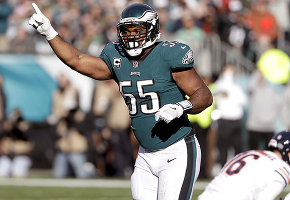 Brandon Graham #55 - one of the main reasons the Eagles are in the NFC Championship.
 Monsoon Martin
Follow up:
Percentages! I will do percentages this time for K-12 and for postsecondary (colleges and universities).
Tuesday cancellation - K-12 17.44% - POST 5.41%
Tuesday early dismissal / partial cancellation - K-12 31.59% - POST 27.88%
Wednesday delay / partial cancellation - K-12 73.41% - 64.55%
Wednesday cancellation - K-12 42.32% - POST 19.53%
Thursday delay / partial cancellation - K-12 11.57% - POST 3.47%
Upper 30s by Friday.
40s on Saturday.
50s on Sunday / Monday.
Next good chance for wintry weather: 1/31 through 2/3.
Monsoon Martin
Update to the update - 8:35pm
Have nudged a couple of my percentages slightly upward.
Tuesday cancellation - K-12 19.48% - POST 6.77%
Tuesday early dismissal / partial cancellation - K-12 54.54% - POST 32.99%
Wednesday delay / partial cancellation - K-12 79.41% - 68.55%
Wednesday cancellation - K-12 44.32% - POST 22.53%
Thursday delay / partial cancellation - K-12 11.57% - POST 3.47%
