
Update on Saturday's storm
Hi.
I stand by everything in my previous forecast (posted yesterday - Thursday 2/15).
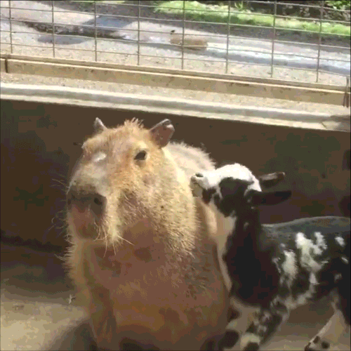 A goatlet (that's what a small goat is called - look it up) jumps onto and offa a capybara (which means "chunky chipmunk" in Portuguese). It makes me happy.Except the part that says "2-3 inches of wet snow at most." This will still be a wet snow, but right around here (Berks, Lehigh, points north) looks like the "sweet spot" that could get 4-5 inches.
Time frame on this quick-moving storm is from 5-6pm Saturday to about 1-2am Sunday. So avoid travel during that window if at all possible.
 Monsoon Martin
 Post a Comment
 Email
Email Print
PrintSaturday, February 17th, 2018
When I said there was "nothing hinky coming," I suppose I spoke too soon.
Although we're in for a bit of snow on Saturday, it's not a major storm.
Here's what I think (as of Thursday 2/15, noonish):
It's going to get progressively cloudier throughout the day today, but really mild - high near 60. Expect rain after about 7 or 8pm, continuing overnight into Friday morning. Since the temperatures will stay in the mid 50s (even overnight), we're not at all concerned with freezing action with this.
On Friday we'll see the temperature drop throughout the day: 50s during the morning commute, 40s in the afternoon (with increasing winds), 30s in the evening (with diminishing winds), 20s overnight.
 Happy 93rd birthday on February 17th to one of my favorite actors, Hal Holbrook. He is best-known for his critically acclaimed one-man stage show portraying Mark Twain - and, of course, his pivotal role as background informant "Deep Throat" in the film All the President's Men.Saturday starts out clear and sunny, but clouds up toward mid-afternoon as a fast-moving front approaches. Expect snow (wet, and maybe mixed with some rain at the start) by 4 or 5pm. The bulk of the snow should be from about 7pm Saturday to about 2am Sunday.
Accumulation: 2-3 inches of wet snow at most. Some slippery spots, but the relatively warm ground temperatures recently will help minimize this problem.
So the storm may impact your plans on Saturday evening and Sunday morning, but the bulk of the weekend remains viable for errands and outdoor merriment.
Sunday turns out sunny with a high in the mid 40s.
And then back up to the 60s by Tuesday and Wednesday! So any snowfall will be outta here quickly.
As this storm gets closer, its actual track/impacts/accumulation will become clearer, so stay tuned for updates!
It's the middle of February and highs are in the 40s-50s-60s - so is winter over?
Nah brah.
But there's nothing hinky coming, so that's good.
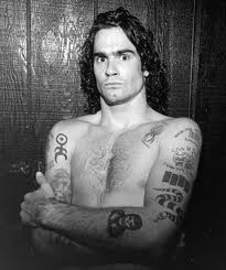 Hey there, crazy eyes! Happy birthday.First, let me wish a happy 57th birthday to Henry Rollins (born Henry Lawrence Garfield). For those of you unfamiliar with him, he was the lead singer of the punk band Black Flag, has made a bunch of kick-ass albums with his eponymous solo band, and tours relentlessly doing "spoken word" pieces that are one part political rant, one part observational humor, and two parts masterful storytelling. In this brief clip, Henry talks to Stephen Colbert about the value of anger.
The weather, though.
Wednesday, February 14th: sunny to start, high near 50. Rain later. But only rain. Overnight low in the lower 40s.
Thursday will be foggy and variably cloudy. Rainy at night. Unseasonably mild: high in the lower 60s, low in the upper 40s.
Friday will be a day of contrasts: rainy to start with a high in the 50s; low Friday night all the way down to the mid 20s.
Sunny and cold on Saturday 2/17 with a high in the mid 30s. Chance of snow showers overnight Saturday into Sunday, but no accumulation or travel impacts.
Mid-40s and partly cloudy on Sunday. Similar action on Monday.
Tuesday 2/20 and Wednesday 2/21 will be very similar to the next couple of days: mild (highs in the mid to upper 50s) with rain and drizzle, and foggy dampness, and what have you.
And then cooler again on Thursday. Sunny with a high in the low to mid 40s.
So wait, Monsoon. We're almost to the end of February in this forecast. No snow to speak of. I told you winter was over.
Not so fast, Skippy.
The period from February 28th through March 8th looks unseasonably cold and uncharacteristically active in terms of snow/ice/sleet/freezing rain. So potentially kind of nasty. Delays are likely.
And then there's always the chance for a wintry Nor'easter from mid-February through mid-March.
So stay tuned for updates!
Remember to submit your questions about the weather (or not the weather) to me via email.
Monsoon
Should we talk about the weather? (hi, hi, hi)
Just had that song in my head.
Anywho, the weather.
Becoming milder!
Friday will be overcast with a chance of widely scattered flurries in the afternoon. No big deal. Seriously. Temperatures in the mid 30s for much of the day.
Saturday and Sunday look rainy, but the good news is that it'll be rain (not snow or mixed precipitation). It'll also get warm enough (upper 40s on Saturday, lower 50s on Sunday) that the existing ice/snow slop will melt. Downside of that: the rain (which will be heavy at times, particularly on Saturday night and Sunday morning) could combine with the icemelt to cause flooding. :(
Travel note: we could see some fog on Sunday morning, so watch out for travel delays (by air or by ... wheels) due to fog, rain, flooding, whatnot.
Monday 2/12 looks a bit chillier behind that rain-producing front. Expect highs in the low to mid 40s with overnight lows in the mid 20s. Pretty cloudy, too.
Partly cloudy and seasonable with highs in the lower 40s and lows in the mid to upper 20s on the following dates:
Tuesday 2/13
Friday 2/16
Saturday 2/17
Sunday 2/18
But what about Wednesday 2/14 and Thursday 2/15, Monsoon? Why have you skipped those dates?
I AM SO GLAD YOU ASKED.
There may be a lil bit of snow/rain on those days. Not huge amounts, and not steady. But enough to be a nuisance.
(Did I oversell that?)
Of course, track and temperature will be key, so there will be updates forthcoming.
Fret not, dear readers.
And stay tuned for updates, why doncha?
THE EAGLES ARE SUPER BOWL CHAMPIONS!!!!!
Amazing. That was just ... breathtaking.

So, focusing on Wednesday's weather: it's going to be a lot like Sunday. Snow, then freezing rain. Slippery driving.
Here's my call, subject to updates / tweaks:
Precipitation begins as snow between 5 and 7am Wednesday.
Sometime between 11 and 1, snow will mix with sleet (frozen pellets) and freezing rain.
Freezing rain (rain that freezes onto surfaces) becomes plain rain (rain that just stays water even when it hits the ground). Expect this to happen between 2 and 4.
And there may even be some mixing back to snow as precipitation ends between 8 and 10pm.
Accumulation: 2 to 4 inches of snow, with .1 to .2 inch of icy crust on top. (This is for Berks. Northern Berks, Schuylkill County, and the Poconos could get higher amounts.)
In Philadelphia and its immediate suburbs, central and south Jersey, and even Lancaster, expect little to no snow accumulation, but (potentially more hazardous) extended periods of sleet and freezing rain.
Impacts: slippery travel, especially on secondary roads, driveways, and lots. Expect hazardous travel between 8am and 2pm.
Schools: timing and temperature are everything, which is usually true with winter forecasting, but especially in this case.
Chance of delay Wednesday, 11.31%
Chance of cancellation Wednesday, 38.14%
Chance of early dismissal Wednesday, 16.52%
Chance of delay Thursday, 67.33%
Chance of cancellation Thursday, 11.22% [note - I forecast the weather. My percentage for Thursday does not account for area schools that may actually close for the Eagles Super Bowl parade.]
Stay tuned for updates!