The first one, affecting the region overnight Thursday into Friday, is relatively weak and fast-moving, so impacts should be minor to moderate.
The second one, heading at us from Saturday afternoon to Sunday evening, has the potential to be significantly disruptive and messy. And it will usher in the coldest air of the season. By far.
But I'm getting ahead of myself.
Thursday will be partly cloudy with a high of 31. As clouds roll in, we could see an isolated snow shower or two as early as 5 or 6pm, but generally the snow will not begin in earnest until 8-9pm (Berks) and 9-10pm (Montgomery). Snow continues intermittently (and of varying intensity) until about 5-6am (Berks) and 6-7am (Montgomery). Storm totals: 1-2.75 inches (Berks) and .33-1.41 inches (Montgomery). Slippery conditions can develop quickly--even with just a coating of powdery snow--so be careful.
Classic two-hour delay scenario setting up for schools on Friday, so hey, there's that.
Alright, so the weekend.
There are a lot of "moving parts" to this system. It's not just a huge area of moisture that we can follow into the region, and there's a lot of instability throughout the atmosphere--and uncertainty regarding the precise track--that could have drastic ramifications in terms of amounts, precipitation types, and whatnot.
This is not to say that I cannot or will not give you a forecast. To refuse to do that would be wussy. And I may be a wuss when it comes to (and this is not an exhaustive list) sullying my hands or approaching a spider, I am most certainly not a wuss when it comes to forecasting.
Go big or go home, I always say. (Again, in almost every other scenario, I would absolutely go home. But not this one.)
Snow begins Saturday 12-1pm over the entire area. Expect some heavy snowfall rates Saturday afternoon and evening. There will be mixing (late evening and overnight) that may result in significant icing. Expect a period of freezing rain (rain that freezes onto the surface) on Sunday morning before changing back over to snow on the "back end" - Sunday between 12 and 6pm.
Right now, I'd say we should expect total snow accumulations of 8-10 inches in the Lehigh Valley and northern Berks, with higher amounts in Schuylkill County and the Poconos. Dunder Mifflin could see as much as 18-22 inches.
Southern Berks, Lancaster County, Montgomery County, whatnot: 6-8 inches with some ice thrown in for shits and giggles.
Philadelphia could see very minimal snow accumulations from this system: 2-4 inches at most. South Jersey and Delaware will likely see all or mostly rain.
Other selected predictions:
Princeton, 4-6 inches
Nutley, 8-12 inches
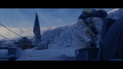
And then it gets so frickin' cold, you won't even believe it. Remember that part in The Day After Tomorrow when it gets so cold that everything goes limp and then freezes and then crumbles apart? Well, not that bad. But still.
 Note the savvy product placement from Wendy's.
Temperatures Sunday evening and overnight will plunge into the single digits (5 in Berks; 8 in Montgomery) and it will get very windy Sunday evening (15-20mph with gusts over 30), so wind chills will plunge to the negative teens by Monday morning. If school were in session on Monday, there would be at least a two-hour delay. But since it is an in-service day, teachers and staff will be expected to report at normal time. *shrugging person emoji that I can't figure out how to insert into this forecast*
High on Monday reaches 17 (Berks), 19 (Montgomery); still pretty windy. High on Tuesday reaches 27 (Berks), 29 (Montgomery); not nearly as windy.
Rest of the week: highs in the 30s.
Following weekend: cold as balls again. Highs in the low 20s; lows in the single digits.